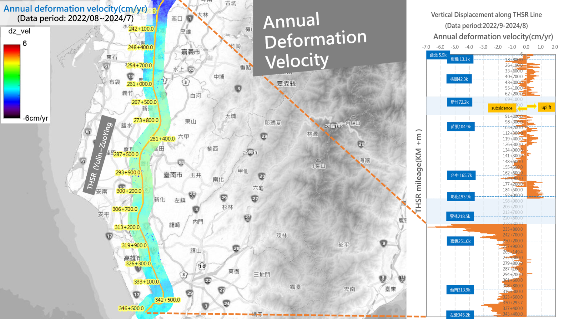
Ground Deformation Monitoring & Urban Resilience
InSAR techniques and long-term satellite archives are utilized to detect ground movement in high-speed rail corridors, urban centers, and other critical infrastructure. These insights support the assessment of land subsidence, slope instability, and urban vulnerability enabling safer infrastructure planning and enhanced climate resilience.