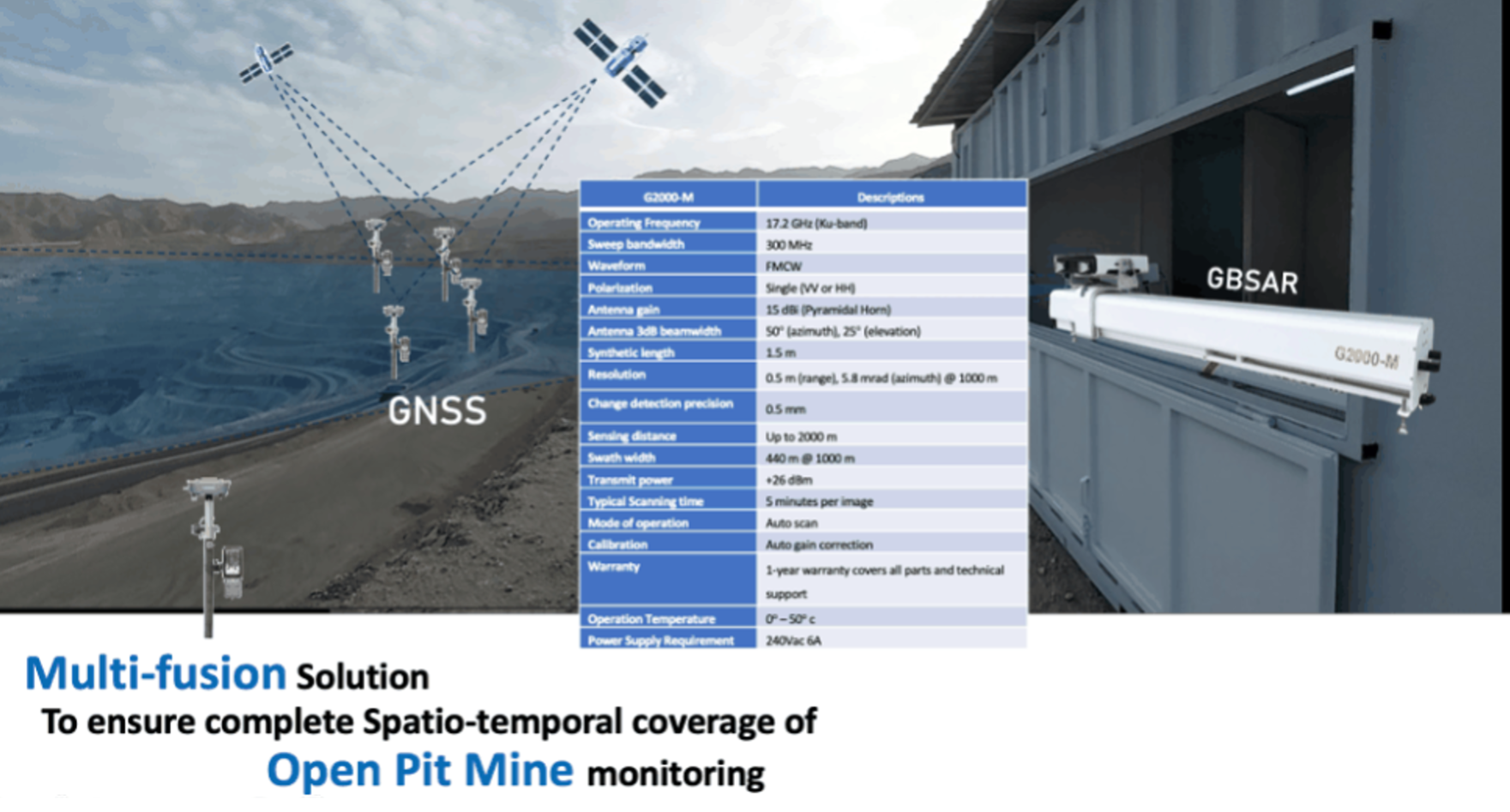
Ground SAR
Terrestrial InSAR / Ground Radar Solutions
High-precision ground deformation radar systems used for real-time slope monitoring, mining operations, and infrastructure stability tracking. These systems complement satellite-based InSAR and can be rapidly deployed in the field.
Use Cases :
High-speed rail embankments, landslide-prone zones, dam monitoring.