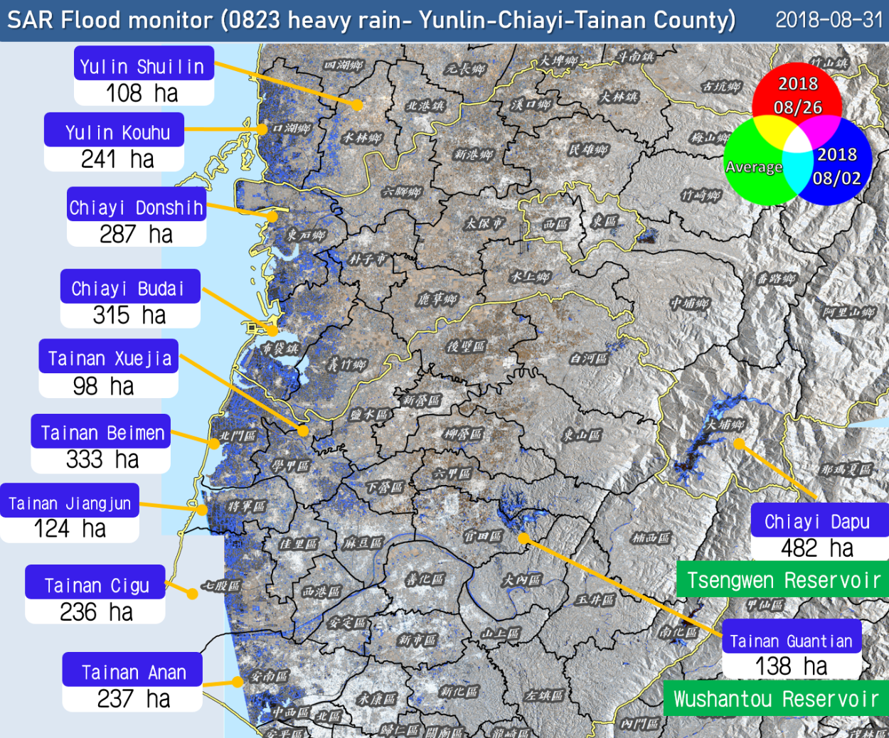
Disaster Response & Risk Management Analytics
Satellite-based analytics provide critical data for emergency preparedness, impact assessment, and post-disaster recovery. Applications include rapid flood mapping, wildfire detection, landslide monitoring, and more supporting timely, data-driven decision-making for governments, NGOs, and humanitarian organizations.